About Landscope

With over 30 years of experience, Landscope has established itself as a leading land surveying consultancy in West Bengal. We are known for our commitment to accuracy, transparency, and timely delivery, supporting a diverse range of projects, from private land measurements to large-scale infrastructure and government development initiatives.
Our experienced team, equipped with modern surveying tools, delivers high-precision data and clear documentation that meets both regulatory and client expectations.
Why Choose Landscope?
-
Licensed & Experienced Surveyors: Backed by a team of professionals with deep regional knowledge and technical expertise across diverse terrains.
-
Modern Equipment and Software: We utilize the latest GPS systems, total stations, drones, and CAD/GIS tools to achieve industry-leading precision.
-
Timely Delivery: We understand project timelines and ensure quick, reliable execution that does not compromise quality or compliance.
-
Comprehensive Reports: Our detailed documentation supports approvals, planning permissions, legal proceedings, and engineering workflows.
We proudly serve a diverse range of clients, including real estate developers, architects, engineers, civil contractors, government bodies, municipal authorities, landowners, and legal professionals, delivering accurate surveying solutions tailored to the unique needs of each industry.
FAQ
A land survey is a detailed measurement and mapping of a property or land area to determine boundaries, features, and elevations. It is essential for legal documentation, property development, land acquisition, and construction planning.
The cost of a land survey in Kolkata varies based on the size, location, and type of survey required. For a quick estimate, feel free to contact us with your project details.
We offer a wide range of surveys including boundary surveys, topographic surveys, engineering surveys, cadastral surveys, obstruction surveys, and inspection surveys for various industries and legal needs.
Yes, we provide accurate and timely land surveys for residential plots, apartments, housing societies, and private landowners throughout Kolkata and neighboring regions.
Absolutely. We conduct obstruction surveys and prepare compliant reports required by regulatory bodies such as the Civil Aviation Authority, municipal authorities, and other government departments.
The timeline depends on the type and complexity of the survey. Most standard property surveys are completed within 2–7 working days. Larger or government-mandated surveys may take longer.

Expert Land Surveying with precision, reliability, and integrity
At Landscope, we deliver high-accuracy land surveying services tailored for real estate, construction, infrastructure, and development projects. With a reputation built on trust, cutting-edge technology, and decades of combined experience, we are your reliable partner for all surveying needs.


Our Services
We provide fully equipped survey teams on both short-term and long-term engagements to support client-specific requirements. Our professionals are trained to operate in high-security zones, ensuring strict adherence to safety, confidentiality, and compliance protocols.

CADASTRAL DIVISION
We specialize in a wide range of cadastral surveys and boundary survey services for private clients across West Bengal. Every year, we successfully complete numerous projects, including as-built surveys for land acquisition, layout surveys, and stakeout surveys. Our cadastral division ensures precise land boundary mapping, enabling clients to confidently navigate legal documentation, site planning, and property development with compliance.

ENGINEERING DIVISION
Our Engineering Survey Division leverages advanced mapping and design software to deliver accurate earthwork calculations, including cut and fill volume estimations. By comparing the original ground surface model from a detailed topographic survey with the client-provided design parameters, we help streamline site planning, grading, and construction decision-making with precision and efficiency.

TOPOGRAPHIC SURVEY
We have conducted numerous topographic and engineering surveys for major infrastructure and development projects across Kolkata, Jalpaiguri, and other parts of West Bengal. These include surveys for new bridge alignments, highway planning, and railway colony developments. Our detailed ground elevation data and surface mapping support accurate project planning, design, and execution in both urban and semi-urban environments.
Portfolio

BARRACKPORE CITY-Model

PURULIA PROJECT-Model

KEUTIA PROJECT

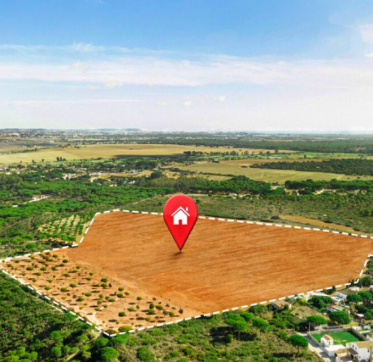
ARKHALI & AMDANGA PROJECT-Model
Request a Survey Quote
Need a land survey for your next project? Contact us today to schedule a free consultation or get a custom quote. We serve Kolkata and surrounding areas with fast, reliable, and affordable surveying solutions.
📞 Call: +91-9609372455, +91-7501243113
📧 Email: landscopeofficial@gmail.com
📍 Location: Sonadanga, Kamdevpur, Amdanga, North 24 Parganas, West Bengal - 700125